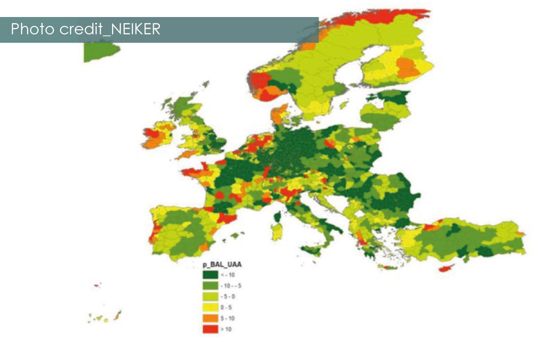
Using the geographical viewer developed in SEA2LAND, maps of the P requirements of the most common crops across Europe in Nut 3 and of the potential P inputs (from local organic residues) have been produced for the different geographical areas. In this way, the imbalance between P needs and “local” P available at this level has been calculated for the whole of Europe. As can be seen, the results show that the Central European area is, in general terms, a net P demander (green areas), while the surplus is mainly located in coastal and mountain areas… this could be due to the decoupling of agricultural and livestock areas.
When defining fertilisation guidelines, the availability of P in the soil, which may have been caused by decades of phosphorus fertiliser application, must be taken into account. The present work only specifies whether or not crop needs can be covered by certain organic residues from the surroundings.

BAL_UAA: Phosphorus balance per hectare UAA (kg of P/ha)
Further information: www.sea2landgisviewer.eu